DrawLine
It plots a line between the coordinates defined at the option GISCoords. This command doesn’t have arguments, but it requires the user to previously define the coordinates for the line as follows:
set GISCoords=[myLong1,myLat1,myLong2,myLat2]
Where myLongX and myLatX are longitude and latitude for describing the beginning and end of the line as shown in Figure 29. In Figure 29 we are drawing a green line (4 pix thick) at the same location of a Line to highlight it.
GIS DrawLine
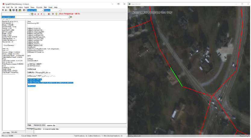
Figure 29. Drawing a green line within the map