DrawLines
This command enables the user to draw a polyline on the map. Once this command is executed, the user can go to OpenDSS-GIS and start drawing the polyline by clicking on the map at the points where the polyline edges will be, this will update the map dynamically drawing the polyline as shown at Figure 35.
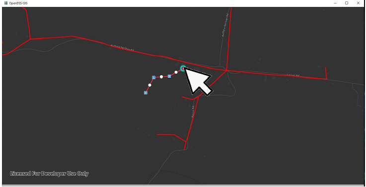
Figure 35. User sketching polylines on the map
After drawing the polyline, the size and coordinates the the polyline can be edited by using the white circles across the polyline to alter the polyline topology as shown at Figure 36. Once the draw is finalized, the user needs to execute the command StopDraw to save the polyline coordinates in memory for futher queries.

Figure 36. Altering the polyline topology