MapView
Updates the map view in OpenDSS-GIS using one of the following as argument:
- Streets
- StreetsVector
- StreetsNight
- Satellite
- SatelliteLabels
- SatelliteLabelsVector
- DarkGrayCanvas
- LightGrayCanvas
- LightGrayCanvasVector
- Navigation
- OpenStreetMap
For example, to update the map view to the streetsNigth view use GISMapView as follows:
GIS MapView StreetsNight
Then, OpenDSS-GIS will change the map view as shown in Figure 32.
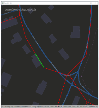
Figure 32. StreetsNight map view
Use the multiple arguments provided above to change the map view for highlighting different GIS aspects of the terrain, adding/removing labels, among others.

Figure 33. Map views in OpenDSS-GIS